Uncover how GEOINT is revolutionizing defense strategies with satellite imagery, mapping, and spatial data analysis.
This category brings you the latest in geospatial technology that provides critical insights for mission planning, situational awareness, and operational success on the ground and in the skies.
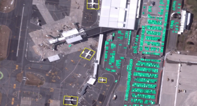
BlackSky has unveiled its first AI-driven analytics from high-resolution imagery captured by its Gen-3 satellite, slashing analysis time from days to minutes.